Showing posts with label maps. Show all posts

5.16.2011

St Petersburg

Ever been to Russia? I haven't, but with the power of the internet I can pretend.

WARNING! Do not use this map for navigation purposes. The scale is all wonky and I forgot a bridge!

11.18.2010

Holy jumpin'!

Just when the internet is getting you down it shoves something in your face.

Deconcrete, a blog far better designed and probably just plain better than mine, decided to show me this.

Talk about disassembling the urban!!!
I'm not going to repeat what they say so succinctly. Just suggest you have a look at the pictures, and the article they link to. It's in French, but it's time you learned.

10.14.2010

map

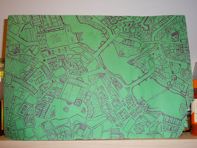
Hi blog. Here's a thing. An attempt at showing depth and differing heights for both buildings and geography. An interesting experiment that didn't end up as magnificently as hoped. Still, pretty neat and I learned a lot about pens...those numbers on pens don't translate directly into how wide their nibs are.
Also, it kept smudging like crazy so I stopped elaborating it with pencil. I suppose I still might go back and add more but it looks alright like this.

HUGE PRIZES for he or she who can identify the city that inspired this map.

5.12.2010

and that other thing

First this link. It's a show entitled Whose Map is it? I don't know the answer, but it's a bunch of people subverting "the socio-political structures and cultural hierarchies that traditionally inform mapmaking." Sounds like something I'd try to do.

Anyway...someone should send me to London.

Also, for those who follow the ol' tweet machine I promised a tale from yesterday that I forgot to include in my thrilling recounting of my walk.

Leaving the practice space I saw a pretty lady across Ossington, heading north while I strode south.

I crossed the road and as I did I glanced back, catching her making a similar neck rotation (romantic notions just ooze from my word choices).

Who knows why I caught her eye, the point is it happened. And yes, she might have been looking past me, but what's the point in assuming that?

The glance-back-sync-up is always fun, although I never know quite what to do with it.

In this case my response to the situation was two-fold. Step one involved mumbling babe, babe, babe under my breath as I continued walking, passing other people on the sidewalk. Step two was me thinking I should probably look back again, because if one glance-back-sync-up is fun, a double whammy would probably be époustouflant (it's French, look it up).

So I looked, and I couldn't see her because the girl who I had just passed, while mumbling babe of course, was blocking my sight line. Also, lady the deuce doing the blocking had turned to look at me for my second glance-back-sync-up in a row.

Two in a row!

So what if the second was unintentional on my part. She now has a tale of passing romance to tell, or she's writing an entry on her blog...The Weirdos I See Outside CAMH.

5.10.2010

data maps of the Brit election

See how much fun data can be!
The Guardian has made these awesome maps with their data.

They've also done some fun stuff with the data and listed it here.

Or if it tickles your fancy you can get an entire spreadsheet with all the data here. Votes, swing that took place...anything you could want!

My data collection is coming along. So far a bunch of street names, but it's a start.

Also, isn't The Guardian just an awesome news entity? The things you can do with a little distance from the market and its profit generating mindset.

(Also, more here.)


5.04.2010

tracerouting with gps

This video was done over 5 years and 8000km by a cyclist who had a GPS affixed to his person at all times.


Originally found here.

Pretty neat.

I have some ideas about making maps based on my movements throughout the city.

Initially they were about tracing my meanderings onto an already drawn map, but that quickly shifted to something like this where the city, or at least my city, emerges from a blank canvas. The second idea seems much more suited to encouraging discussion on what a city really is.

Can you consider it a part of your city if you've never seen it? Maps give the impression of knowledge...how is that knowledge compromised by walking a street again and again? Never having actually been somewhere? Only having driven a road, never walked? ...And so on.

My mapping project also leads to all sorts of fun considerations around how to map my movement. Just a foot map? If it includes cycling or public transit how are those recognized? Do I try to draw the map to account for speed? For time travelled? Distance? For experience and depth of engagement with a route or destination?

I think the solution to all that might be to simply start a journal, or just have a sheet of paper on my room wall where I make notes whenever I get home. Recording my movements, modes of transport, experiences had or shared...whether I was walking alone or with others is a good stat too.

Or I could cease being Ludditic and get a GPS machine of my own...along with a notebook for all the mushy non-scientific stuff.

Anyway, the point is collecting the data.

And the video also made me realize why facebook, google, etc are all excited about data. Data is the hard part. Once you have it, there are all sorts of things you can do with it, but you have to collect it first. As I consider this project the data collection is the part that strikes me as daunting...the aftermath of expressing it in whatever form or forms, that's just exciting. There are so many ways to go about it and if I mess it up or do something I don't like the data will still be there.

No one will possess more data on me than me!!! I'll commercialize it and make so much money.

Clowning tomorrow. Also a full day at work. Good times I hope.

3.09.2010

map cuts!

Holy smokes! So many people are into maps. It's great!
Daydream sent me this link from boingboing.

This Karen O'Leary lady has done so many of these things I don't know where to begin.

Here's a Vancouver piece from her Etsy page (Etsy of course being an online fashion/art/handmade stuff marketplace that comes highly recommended by Ms Fascinator, amongst others).
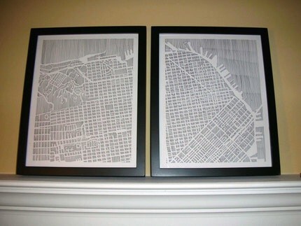
On this one it looks like she has used an actual map and simply cut out all the bits that aren't roads, really showing how it's the roads that tie the city together. Cut the other way and remove the roads and all you have is a bunch of squares floating to the ground.
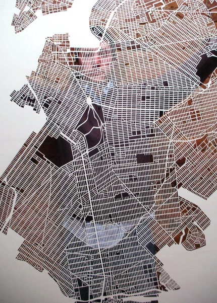
But if it's the roads that are holding the city together shouldn't we be making more efforts to ensure roads are given over to people, not cars? Of course we should. It seems dumb to exclude the actors that bring life to the city from the physical space wherein the city's component parts are secured to one another. I'm not saying ban cars, just think about it for a moment and you'll catch my drift.
According to her description this map of Paris is made with heavier stock, watercolour paper. I assume she traced everything on then went about cutting it in the same way.
And again, something similar with New York. This is one from a set covering the whole city and is apparently done on lighter paper.

There are a whole whack more of these on her Flickr.
NYC again.

Keen, really just keen.

She also does some in pen and paper.
Great. And then she can put them onto cards, magnets, etc.
I'm super glad this was sent to me. These pieces are great and show me some possibilities. I've been chopping up a few things lately (I need a better knife and chopping surface) but the idea to remove most things and leave only roads in situ never crossed my mind.

I skipped right past that step and have been thinking about manipulating roads. Cutting them from their surrounds but instead of leaving them, changing their configuration, hopefully so that the roads themselves are still recognizable while their form has gone haywire. I suppose that might mean they will become unrecognizable, but I guess that can be part of the fun too. Make an interesting and aesthetically pleasing image, using a map as material, and only later upon closer inspection will people realize that they're looking at something familiar.

Heh. I should DO that, then I won't need to wonder such things. I wonder if that idea would work better with a a provincial road map or a city street? Oh! Or if I used one of those map books for a city that are done with a large scale. Go from page to page, following a road, then mounting it somehow. Anyway...thoughts from my brain.

I'm reading a few of the comments people are posting below the boingboing article, asking whether the pieces are diminished if they were laser instead of hand cut. I don't have an answer to that, but I'll admit there were moments when I was drawing this map
that I was wondering if it wouldn't be better to just learn AutoCAD instead. Probably not. It's about the process after all and it's not like I'm interested in efficiency! Although now that I have my map in digital form I'll likely manipulate it eventually.

I suppose if I keep going with evenly measured maps then a computer construction might make more sense, but it's not like I could make this with a computer.
Why would I want to? As this marker on construction paper monstrosity and Ms O'Leary's efforts at hatching a city show, there is so much fun to be had with variety in making and manipulating maps. So, computers? Whatever!

That's enough from me, but in closing I'll mention that I recently made a connection between why I like maps and how I interact with the world more generally, but I'm not telling you yet. Hint: it's about the big picture!

3.08.2010

Maps I have dug out

Clean wall in the living room needed some decorating and this is the result.

After much searching I settled on this map of Morocco.
Look at those big bold colours.

I also cut this little dootle bopper out of a larger tourist pamphlet.
It's in a frame but isn't hung yet. We'll figure something out, although it looks lovely just like this.
I also found a really great early 1970s street map of Chicago, but it is too big and a bit flimsy for a wall hanging without modification.

That's the tough thing about some of these maps. I have them in a box and they should be seen, or else what's the point? But is it worth displaying them if they might be damaged in the process? And some of them are really big and not suitable for normal sized walls.

I liked the Post Houses series above because I cut it out of a pamphlet that would have been too big to show otherwise. I'm going to continue doing this, cutting interesting portions from boring maps and displaying them either alone or perhaps start working on map collage projects.

Experiments!

Man am I lazy when it comes to blogging. I have a post I've been working on about patience, but it's taking me forever to finish. So, I guess...keep waiting for it?

Heh.

In regular life I was fitted today for the costume I'll be wearing over March Break at BCPV. Bring on the wee ones!

Daydream brought me too much meat from chef school and now I'm tired. Stupid late afternoon meat naps. THE WORST!


2.25.2010

I don't do much these days

Not particularly inspired by anything. Except improv, but there's sadly not enough of that in a week.

Olympics are on.

Meh and Angry Meh would be my main emotional descriptors of late.

Got out of the house today, saw some kids throwing snowballs and that was pretty great. Two kids were on top of the slide and had a toboggan, or maybe just apiece of plastic, as defence. All the other kids were throwing snowballs at them. Everyone seemed pleased.

Then I found a chocolate museum. Then I bought groceries. Then I found a Winnipeg atlas at the Salvation Army store that is a consistent source for random maps and atlases.

Oh, and I also got a membership at the Trinity Community Centre. $40 for 3 months, what have I been waiting for? Holy smokes. And they have a pool!

I did this thing.
Inspiration from Toulouse, Sauveterre-du-Rouergue, Istanbul, some book with pictures of an Italian town (upstairs, too lazy to look) and other stuff.

Sorry about the glare. You're smart. You'll figure it out.

2.02.2010

Maps and architecture and cities and me and an artist named Alice

I'm never sure how I get onto things, but at some point I found myself on this blog, which led me to one Alice Aycock's website. I thought some of her stuff looked really neat, and not just because she is using a grey background on her page and an awesome orangey-yellow colour for her main title. I'm also excited because her work ties in, however tangentially, with some of my interests in art, urban form, architecture, etc. that I've been reading and thinking about of late. (All the pictures I show below are from her website, where you can find more of her work and lots more information.)

Her stuff is farther down but first...

I recently finished this:
That is a drawing of a city. It's pencil on paper and as you can see my efforts at going over the lines were more aggressive in some parts than in others. I think I might do a series of these, maybe start inking them.

In my map I've largely blocked in spaces in terms of grass, concrete or water. There is also just a bit of detail (roof lines and some differentiation for docks) in some of the 'built' blocks. I've added some colour below so you can see what I'm talking about
For the most part, the areas without colour are human structures of one form or another.

This blocking is similar to how a Toronto mapmaker dealt with the problem of describing a city in 2-D from above. Leaving most blocks as blocks and restricting built detail to the ghosting of large institutional footprints. No little lines for house roofs in this one.
But then I came across this image on Aycock's site. What would I do for a building with a hat on?
Low Building With Dirt Roof (For Mary), 1973
I never considered how green roofs or any rooftop park would play in a map until I saw this picture. The traditional top-down view for maps works because things are simplified, often with the notion of single land use. But when there's a significant built park in a city, even if it's high in the air, it needs to be acknowledged. People following a 2-D map and finding a building where they expected green space would be surprised, so there needs to be differentiation of some type, whether it is colour, shape, labeling or something else.

And if I decided to take on a utopian mapping project (I quake even at the thought) I would need to consider the mixed land use that might be taking place on a very fine scale. Methinks I need to start drawing on bigger sheets of paper. More to follow on this theme, no doubt.
"The City of Walls", Isometric, 1978
The Garden of Scripts (Villandry), 1986
Maze, 1972
Walled Trench/Earth Platform/Center Pit, 1975
A Simple Network of Underground Wells and Tunnels, 1975
Project for a Circular Building with Narrow Ledges for Walking, 1976
I like these pieces because they are able to experiment with ideas of structure and architecture, without being concerned with eventual tenants. It's like she gets to play more freely with the signs and signifiers (pardon my weakness in semiotics) of architecture because she's building in farmers' fields. I'm sure she still takes human form into account, but unlike a 'proper' architect she has fewer restrictions. An architect must consider daily human use and if they don't think about how people will live in their built spaces, said spaces stand a good chance of failing.

Looking through the site, I'm definitely a bigger fan of her earlier work. She seems to focus more on architecture and structure than in her later stuff. Starting in the 80s her work begins to take on a more sculptural and decorative air. By decorative I mean there is less concern with function (as vague as it might be) and more with aesthetics. Her sculptures are still fantastic and full of use, it's just that the architecture that remains as a theme in some pieces is often more abstract and less obvious.

I'm always wary of venturing opinions on realms foreign to me (at least in writing, when speaking I venture insupportable opinions on things I know nothing about all the time). I worry I lack the vocabulary to express my notions accurately. Oh well. No offence intended anyone!
Functional and Fantasy Stair and Cyclone Fragment, 1996
And I'm not saying her sculpture is bad. Just that I like the themes she's exploring in her earlier work more.

If someone knows what I'm talking about, feel free to tell me.

Also, everyone should look at the artist's site. There are so many cool things there, even a machine that makes the world! In the meantime, play on this...
The Game of Flyers, 1980
Note at the bottom (that is here): I did an experiment and didn't promote the previous post. The results of the experiment tells me no one has looked at it. If you're interested, it's there and it's about food!

10.29.2009

The Macallan

Wonder of wonders, I was invited to a classy event last night! Finally I understand why I have my hair cut by Enzo from time to time.
(insert photo of me standing around, looking casually delicious - never taken - here)
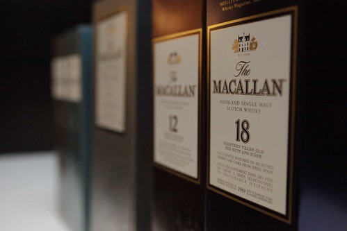
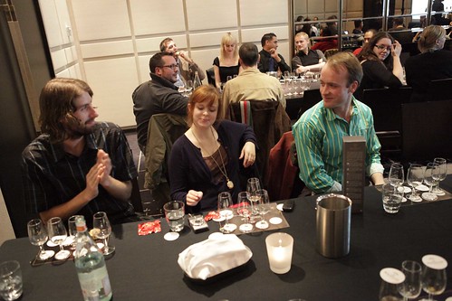
The event was a Macallan scotch tasting and as if that wasn't classy enough One Restaurant (Hazelton Hotel) was the setting and Matchstick played host. Toon was my hook-up and Deck was along as well. Smart girl that Toon, showing up at an event about 90% boys with 2 of her own.
(Toon has more photos - mostly her legs but I'm in there too - here, with the promise of more still to come)
Well. As long as she's happy.

We had the the pleasure of our whiskey guide Marc's knowledge, and 10, 12, 15, 18 and 21 year old vintages with which to wet our whistles.
Much to my delight geography featured heavily in the evening's information. Scotland to America and the north of Spain, we learned all about oaken varieties, cask manufacture and how distinct environments donate flavour to the drink through a woody medium.
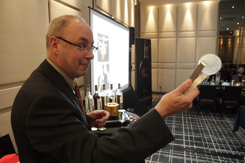
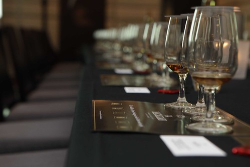
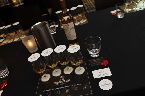
Marc even gave us a chemistry lesson, the relative merits of ice cubes, ice balls and chilled Lake Ontario pebbles. Then threw in some economics as well, focusing on the impossibility of scotch soothsaying. Twenty-one years ago no one at Macallan could have predicted the recent scotch boom that has caused supply and demand conundrums the world over.
Heck, 21 years ago I was tidying up grade 1 art projects with Mrs. Kaufman, oblivious to everything save recess and what was in my nose.
Just like any normal red-blooded male, all the talk about barrel manufacture - bourbon in America, oaks in the north of Spain, 100 year plans for stave manufacture - got me thinking about maps.
Shocker! I know.
A map project that encapsulates the geographic spread of a bottle of scotch and the time it takes to come together would be fun. For that I'd need to think about ways to draw time alongside the spatial language maps are already so good at. There are examples, here's one of Napoleon's ill-fated march on Moscow, so I have a starting point. Don't know what the end result will be, but here's hoping for giggles.
Oh right...the tasting part. Delicious!

The 10 year old was smooth, as was the 12 but with more complexity (is that the word that makes me sound clever?). I found the 15 had more of a smoky edge, it strangely reminded me of some Islay malts. The 21 year old was mellow in an inexplicable and delightful way, one that I can't really remember but know I want to try again. Then the 18...ah the 18. Finally a scotch where I could taste the toffee, the fruit and the layers that all those people that drink the stuff are always talking about. And for the low low price of $289 a bottle!

Let me join you scotch drinkers! Give me money, then let me join you.

But seriously, as Mark repeated over the evening, there's no need to be a snob around scotch. If it tastes right for you, it's the scotch for you. There's so much variety in palate and preference, sometimes changing over the course of a day, to become too concerned with age and cost is to miss the point.

A great event! And to top it off they sent us home with a lovely little loot bag. Tumbler and samplers and tasting cards, oh my.

And I won the draw meaning + one bottle of the 10 year old for me!

Here's me bemused and confused, basking in the glow of applause that broke out (not just Deck) upon my name being announced.
I work hard.
I deserve it.
I think Toon was jealous, then she stole some when I wasn't looking. Thief! Damned thief that brought me to the event in the first place, therefore all is forgiven.

We were even taxi chitted all the way home. Given the evening started with a streetcar driver telling me I don't like being hailed like a cab this seemed like a nice way to finish up.
-some photos courtesy of the organizers

10.14.2009

Cool maps or how I lose an afternoon to the internet

How could anyone not lose an afternoon when this is the image that introduces you to the site? What better way to signify concern in Iceland about joining the EU?
The name of the blog is Strange Maps and that's all it is. Pretty neat stuff.

Also an encouraging site because it's given me a whole whack of ideas for what I can do with some of my maps. The problem I'm having right now is I want to do something, but a lot of the somethings I am considering involve a pair of scissors. The maps are so lovely in and of themselves I'm a little hesitant to go to chop town. I guess that's why they say "You can't make art without cutting a few maps!"
(click through the image for a bigger version!)
This one is neat too. I love hyper-simplified maps. That's probably why I'm a big fan of urban mass transit maps and rail system maps in general. When working with maps that need to carry a lot of information clearly you have to kill the geography sometimes. And that leaves room for lots of 3 dimensional brain translation.

Better than chocolate!